
Survey Topography Plans in Greece: A Comprehensive Overview
Planning to conduct any kind of property sale, construction, or development project in Greece?
The First thing that you need is the survey topography plan. Otherwise called as land plan, or simply topography.
In this article, we will provide you with a detailed overview of survey topography plans in Greece.
Find out what they are, why they are important, and how to obtain them.
What are Survey Topography Plans?
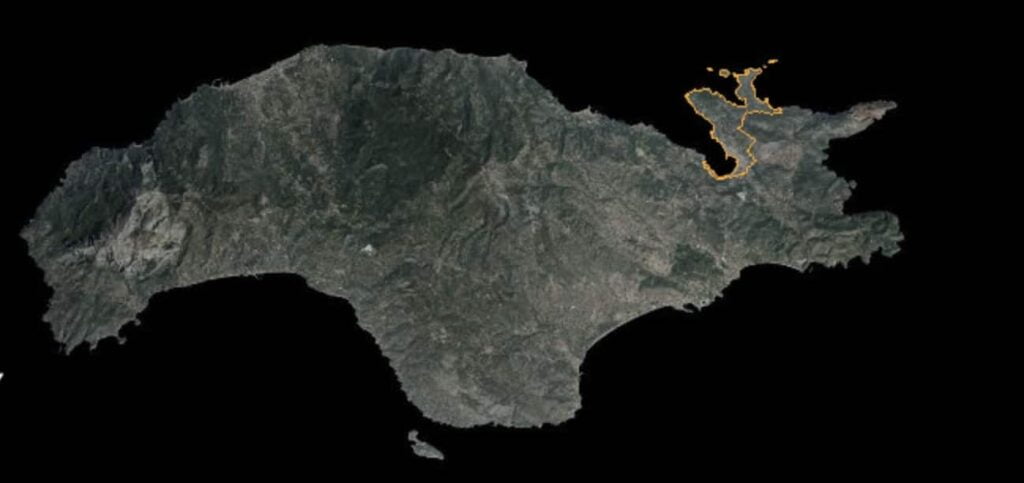
Survey topography plans is a diagrammatic representation of an area of land.
Otherwise known as Site plans, or Lans plans, It maps your property size, shape, boundaries, neighboring properties, location, orientation and Boundary Line GPS coordinates.
They are mainly used to identify the exact boundaries and dimensions of the land, which are important for legal, and construction purposes.
Why are Survey Topography Site Plans Important?
There are several reasons why survey topography plans are important for any construction or development project on Samos, Greece.
Firstly, they can help to identify potential obstacles that may impact the construction project, allowing developers to take appropriate measures to mitigate these risks.
Secondly, they can help to ensure that any development project is in compliance with legal and regulatory requirements.
Finally, they can help to ensure that the project is financially viable, by providing accurate information on the dimensions and topography of the land.
How to Obtain Survey Topography Plans in Samos Greece
In order to obtain survey topography plans in Samos Greece, you have to look no further that Samos Housing.
We have a team of professional surveyor and engineers.
We conduct a detailed survey of the land, using specialized equipment to measure the topography, contours, and other important features of the land.
It is important to note that the process of obtaining survey topography plans on Samos can be complex and time-consuming, particularly if you are not familiar with the local regulations and requirements.
Therefore, it is recommended that you choose an experienced professional like Samos Housing.
Survey Topography Plans
The need for a topography plan on ALL Real Estate Paperwork in Greece
Please Note: A modern survey plan with GPS coordinates is essential and mandatory for any sale of property in Greece.
Together with the electronic building ID from April 2022 it is mandatory to have those documents in order to sell a property anywhere in Greece
We produce detailed survey plans on Samos.
We also produce upon request survey and heights contour plans of your property.
In addition, we also explain in detail what your options are in terms of management of the property, expansion and renovation with appropriate building construction permits.
Survey Topography Plans are essential to every property.
This is where everything begins in terms of buying a plot of land or find out the construction options a property has.
Furthermore, the new surveying plan with EGSA 87 (Greek GPS Coordinate System) in the lack of land registry cadastre still in many areas of Samos, secures your property by pinpointing the location, terrain condition, showing the neighboring properties, any distinctive land features.
It also reveals any positive or negative characteristics.
For example neighboring properties, forest areas, water streams, and other possible features that affect the building capability of your land.
Moreover, The surveying topography plan is the first step of finding out what kind of construction project you can meterialise on your property
Furthermore, Survey plan is the first piece of planning you ask to examine when you are interested to buy a property.
We produce detailed Surveying topography plans of properties on the island using the latest technology.
Theodolites and electronic GPS mapping systems according to the Greek GPS System EGSA 87
Plans of plots and buildings with GPS coordinates specific for all the necessary land claims and sales according to the specifications of the ministry of Environment
Prices start from 250€ plus VAT for small, easy access plots